Ball’s Pyramid
This item appears on page 16 of the February 2013 issue.
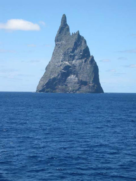
While my wife, Bonnie and I were in the South Pacific on a “2012 Grand World Cruise” aboard Holland America Line’s ms Amsterdam, we sailed by Ball’s Pyramid (coordinates: 31°45'15"S, 159°15'6"E) on Feb. 24, the day before we arrived in Sydney.
Ball’s Pyramid is a rocky, cliff-faced islet rising abruptly from the sea to a remarkable peak. Measuring 1,844 feet high, 3,600 feet in length and 980 feet across, it is classified as an erosional remnant of a shield volcano and caldera that formed about seven million years ago.
Located 12 miles southeast of Lord Howe Island, it is part of Lord Howe Marine Park and is a UNESCO World Heritage Site.
The island pyramid was named after Lieutenant Henry Lidgbird Ball, who discovered it in 1788 on the same trip during which he discovered Lord Howe Island. The first person to go ashore is believed to have been Henry Wilkinson, in 1882, a geologist at the New South Wales Department of Mines.
SKIP CARPENTER
Coronado, CA